Tuesday 13 December 2016

A Scattering Of Stones

In the Diary that he wrote in the 1660's, my old mucker Samuel Pepys recorded his visit to an ancient monument: 'Three great stones standing upright and  a great round one lying on them, of great bigness, although not so big as those on Salisbury Plain. But certainly it is a thing of great antiquity, and I am mightily glad to see it.'

So where in the realm was Pepys wandering? Not Wiltshire, that much is certain from his own words. The lofty moors of Cornwall and Devon, perhaps? Remote isles off the Scottish coast? The Lakes or the Peaks?

None of them. He was writing about Kit's Coty, a Neolithic burial chamber in North Kent, part of a cluster of prehistoric monuments known as the Medway Megaliths.


The Megaliths form two distinct groupings on either side of the Medway valley. On the western side, Kit's Coty, Little Kit's Coty/The Countless Stones, the White Horse Stone and the Coffin Stone sit within easy walking distance of each other while on the eastern side, the remnants of two longbarrows lay in close proximity.

Together, they form the only surviving megalithic complex in Eastern England and, although they are all in various states of ruination, their survival in an area of intense agriculture, riverside industrialisation and heavy transport links is remarkable. They can also, provided one is armed with the knowledge of their exact locations, be visited in a single day.

White Horse Stone


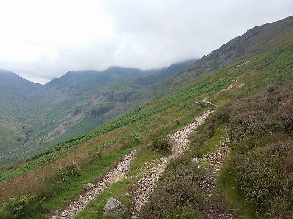
From behind the Cossington Services on the southbound A229, a track crosses a bridge over the Eurostar line and follows the Pilgrim's Way toward the North Downs. Between the track and a field can be found the White Horse Stone. There once existed a Lower White Horse Stone to the west, but it was destroyed in 1823 and its site is now covered by the road. When the Eurostar line was constructed, the site of a Neolithic longhouse was excavated at the point where the railway enters a tunnel, and a now lost monument known as Smythe's Megalith - named after a local antiquarian who investigated it in the 1820's - once stood in the field.

A scattering of smaller stones are strewn across the undergrowth immediately to the west of the stone. I suspect that this monument is a collapsed burial chamber, the main relic being a capstone that has been propped onto its side, and the others its supports.

A scattering of stones
According to the writings of Nennius and the Venerable Bede, the Battle of Aylesford took place in this area, and local mythology has connected some of the Medway Megaliths with this event. It was supposedly fought between the Anglo-Saxon invader brothers Hengist and Horsa and the Briton princes Vortimer and Catigern, sons of King Vortigern. Horsa was killed in the battle and, according to the legend, laid out in state upon the White Horse Stone. Another casualty was Catigern, and his legend is associated with the next site I visited... the site about which Pepys scribbled his review, and which stands about 400m to the west on the other side of the A229.

Kit's Coty


Pepys was not the last notable figure to visit this monument, standing on the southern slope of Bluebell Hill with extensive views across the Medway valley. It was sketched in 1722 by the antiquarian William Stukeley, who also noticed a low, 70-yard mound extending to the west... evidence that Kit's Coty formed the entrance chamber of a longbarrow. A rock known as the General's Tombstone stood at the end of this mound, but this was destroyed in 1867 and the remnants of the mound have since been ploughed away.

Stukeley's sketch of 1722
George Orwell visited in 1938, and reported it as 'a druidical altar of some kind.' It had been classified as a Scheduled Ancient Monument in 1885 and by the time of Orwell's visit had been railed in for several years.

Kit's Coty from the NW
The word 'Coty' seems to have been a local dialectal term for a house, and the 'Kit' a shortening of Catigern, the British prince who died fighting the Saxons in this area and who, according to local custom, is buried underneath it - although archaeological exploration has sadly failed to comfirm this legend.

At the bottom of the hill, opposite the entrance to a vineyard, sits my next destination.

Little Kit's Coty/ The Countless Stones


Apparently destroyed in the seventeenth century before they could be recorded by antiquarians, there are about twenty sizeable sarsens piled in a sprawling heap, showing that the monument must have been visually impressive in its day, perhaps similar to the longbarrows on the other side of the valley.


 The idea that the stones cannot be counted is a familiar motif with Neolithic and Bronze Age sites. Similar legends exist at the Rollright Stones in Oxfordshire and at Long Meg And Her Daughters in Cumbria, to name but two.

Stukeley's sketch proves that the monument was demolished prior to 1722
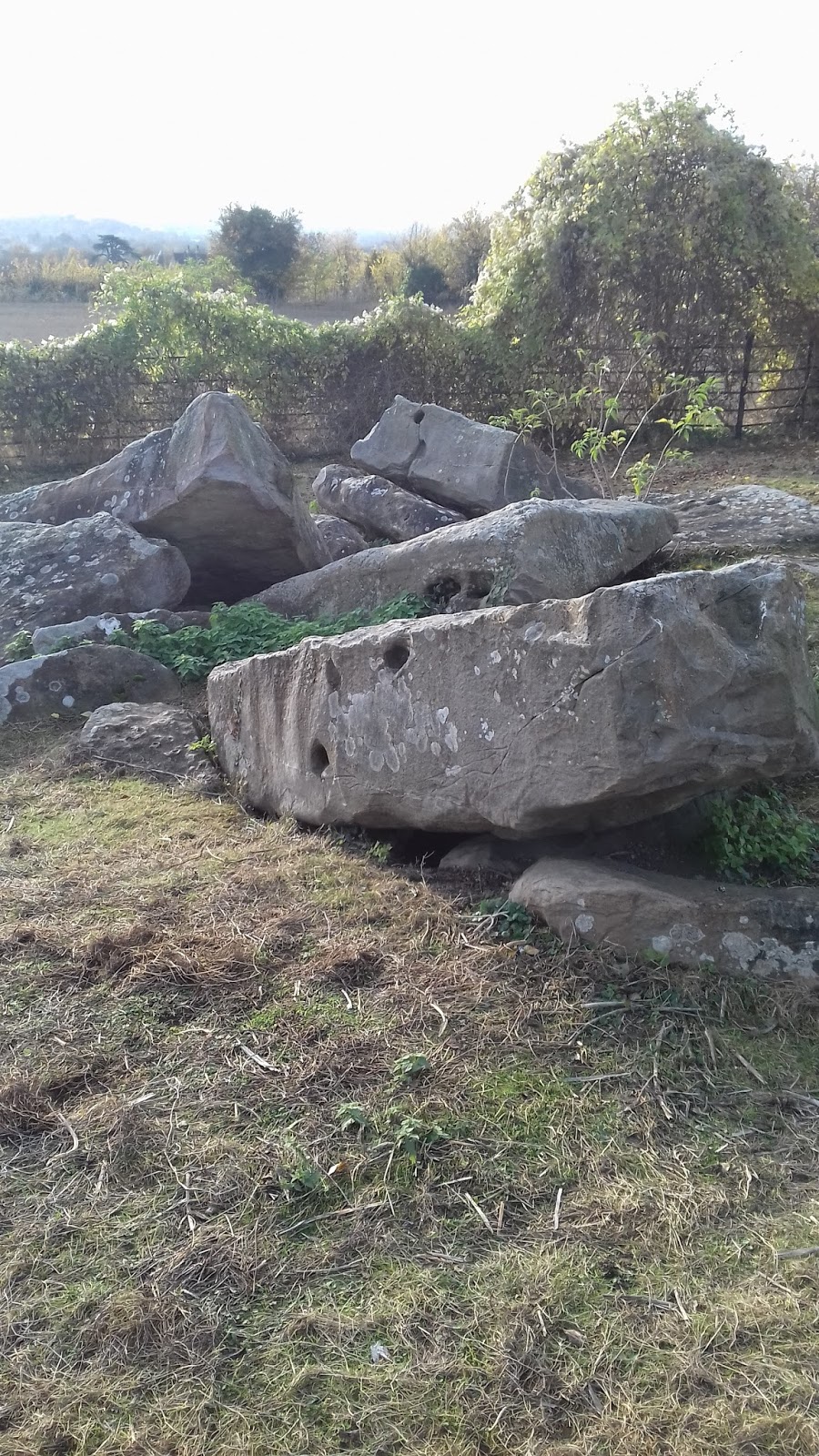
The vineyard across the road shelters the final site of the eastern Medway cluster.

The Coffin Stone


Although a public footpath obliquely traverses the vineyard, direct public access to the Coffin Stone does not exist at the moment, although the landowner hopes to provide access in the future. The uppermost stone was recently placed in its position by the farmer, the original Coffin Stone now underneath. It looks to me very much like a collapsed burial chamber, perhaps very similar to Kit's Coty.


Although the western cluster of Medway Megaliths are only a couple of miles away on the other side of the valley, the River Medway is planted firmly in the way so I have to use my car, making use of the A229 and the M20 as well as a couple of country roads, in order to reach the village of Trottescliffe.

Coldrum Long Barrow


The barrow stands in a pretty spot east of the village, which is pronounced 'Trosley'. It overlooks broad farmland, with the North Downs rising across the fields. As can be seen from the above picture, the stone-built chamber has suffered from slippage, and many of its stones have tumbled down the slope. The mound is surrounded by smaller kerbstones, known as a peristalith, and the spot is popular with practitioners of the Earth Religions - the tree behind the barrow is often festooned with clouties and offerings.

Tumbled stones at the foot of the mound

Archaeological investigations over a century ago uncovered the remains of seventeen individuals, interred over two occasions during the Early Neolithic, some five thousand years ago. The skeletons showed signs of excarnation and dismemberment before being deposited within the barrow.

Bone assemblage from Coldrum
The site's popularity with neo-Pagans means that rituals take place here at all of the major festivals, including Morris Dancing which takes place here at dawn on May Day. Sadly, it seems that some visitors like to build small campfires on the centre of the mound, akin to the tealights which can sometimes be found at monuments such as Wayland's Smithy and West Kennet Longbarrow. Most pagans and megalithomaniacs would severely censure this practice.


Addington Park Longbarrow

Stones from the chamber

Little more than a mile from Trottecliffe sits the neighbouring village of Addington, which contains the remnants of two Longbarrows. The first, Addington Park, is easy to find as a road originating in the village goes right over the top of it.

The chamber lays north of the road, with peristalith stones visible on both sides
Sarsen stone found in various buildings in the village suggest that the barrow has been quarried for building materials in the past, and no skeletal remains have been reported. Some recent subsidence on the road crossing the monument was found to have been caused by tunnelling rabbits.

Perstalith stones south of the road
Chestnuts Longbarrow

This monument is difficult to spot from the road, as it sits in the rear garden of a property called 'Rose Alba'. It is possible to contact the owners and arrange for a guided tour of both Chestnuts and Addington Park, which takes about an hour and involves dowsing.


Archaeological exploration has recovered the remains of nine or ten individuals, although the acidic nature of the sandy soil upon which the monument sits means that quite a lot of organic material may have been destroyed. It was found that deliberate attempts had been made to damage the barrow, probably by zealous Christians - a medieval practice which has damaged many prehistoric monuments in the past, most notably the great complex at Avebury, Wiltshire.

©Adamsan at Wikipedia
As well as the usual prehistoric finds, archaeologists also found clay pipes dating from the seventeenth to the ninteenth century, stone and clay marbles, and bottles from the nineteenth centuries. This was taken to confirm local reports that the Chestnut Longbarrow had, for centuries, been a popular picnic spot for sightseers.

And for this sightseer, another quest is over. The Medway Megaliths, this scattering of stones across a river valley in the Garden Of England, have been visited in a single afternoon and, as I make my way home in the deepening darkness, I realise that there is, after all, an advantage to living in South Essex.

It's close to Kent!


Previous blog articles that included megalithic monuments:

And The White Horse Looked On

Rough Circles

On Going A Journey


Saturday 12 November 2016

Season Of The Witch

For the last couple of years I have managed to post topical articles regarding Samhain events that I have attended in Southwark and New Forest; however, Hallowe'en passed uneventfully this year, with no dancing in urban burial grounds and no druidic rituals on forest plains.

Although Samhain went unmarked this year, earlier in the month I managed to find myself in a place that has a historical connection to witchcraft: the small town of Manningtree, sitting on the banks of the Stour Estuary on the border of Essex and Suffolk, buttressed by the villages of Mistley to the east and Lawford to the west.

Manningtree from the Stour


The circular walk that my Eldest and I intend to undertake officially begins at the railway station on the west of the town, but we have decided to start elsewhere along the loop; therefore, we leave our vehicle along the waterfront, only a stone's throw from the town's most notable landmark: the so-called Mistley Towers.

Mistley Towers

The original church on this site had been built in the classical style early in the Georgian period, reflecting the architectural trend imprinted by Wren and his colleagues on the City of London following the Great Fire. However, in 1776 an ambitious local politician named Richard Rigby, who nurtured plans to create a spa town, employed the renonwned architect Robert Adams to 'enhance' the buiding, and the Towers that stand today are the result.

Adam's church served the community for a century, before being replaced in 1870 by a new church to the southwest. This was built in the Neo-Gothic style, reflecting the change in architectural taste between the Georgian and Victorian periods. The main body of Adam's church was demolished but the Towers were allowed to remain, and today are maintained by English Heritage.

River Stour from Manningtree, with Suffolk across the water


We stride west along the waterfront, heading for the centre of the estuarine settlement which claims to be the smallest 'town' in the country, although it has rivals to this claim ( such as Fordwich in Kent and Llanwrtyd in Powys, to name but two). The mudflats to our right are peaceful, dotted with godwits and lapwings, and boats bob quietly on the water.

High Street, Manningtree

This riverside road, known as The Walls, reaches an art gallery then kinks left up an incline before swinging right into a High Street with a narrow roadway and even narrower pavements. There are plenty of hostelries and tea shops, and little to disturb the street's Georgian feel. Many of these facades conceal older structures behind, and the town contains over a hundred Grade II listed buildings. We purchase a Meal Deal from an unobtrusive Tesco Extra and sit on a bench next to a small market area to enjoy our lunch.

In the medieval period, Manningtree was known for a Whitsun Fair at which a whole ox was roasted. This event was famous enough to be known to William Shakespeare, who made reference to it in Henry IV Part 1, with Henry describing Sir John Falstaff as 'that roasted Manningtree ox, with a pudding in his belly...'  Today, a sculpture of the Ox - complete with the pudding - hangs at Market Cross.

The Manningtree Ox

With our lunch finished, we continue west along what is now called Station Road, which leads to the edge of the town and - no surprise here - its railway station. From here, we take a footpath that heads south across countryside toward the parish church of Lawford, and then we strike east, across fields and through woodland, skirting the southern edges of Manningtree as we head toward the hamlet of Mistley Heath. To our left, across the meadows of Furze Hill, we can see the landmark chimney of the EDME Maltings, and somewhere beyond that lays the site of a 'secret' nuclear bunker.

Maltings Chimney

It is peaceful, attractive North Essex countryside, and yet - during the tumultuous, Civil War-torn decade that was the 1640's - this community managed to nurture one of the most notorious and controversial figures in English history. This was the home of Matthew Hopkins, son of a Suffolk clergyman, the man who descibed himself as the Witchfinder General.

Detail from frontispiece of Hopkins' book 1647 book, The Discovery Of  Witches


Hopkins was born at Great Wenham, Suffolk, around the year 1640, but moved to Manningtree in the early '40''s. East Anglia was a stronghold of Puritanism and strongly favoured the Parliamentarian side in the Civil War. The times were rife with superstition and were ripe for unscrupulous 'gentlemen' like Hopkins and his companion, John Stearne, to enrich themselves by exploiting the gullible. Already the iconoclast William Dowsing had rampaged through the district, destroying stained glass windows and whitewashing church walls as he carried out his commission to destroy 'monuments of idolatry and superstition'.

Hopkins wrote that his career began in 1644 after he overheard a group of Mannngtree women discussing their meetings with the Devil. Stearne seems to have been the dominant figure at first, but their roles were soon reversed. Twenty-three women accused of witchcraft were tried at Chelmsford. Four died in prison, the other nineteen were hanged.

The penalty for witchcraft

With Stearne and a group of assistants named Mary Philips, Frances Mills and Edward Parsley, Hopkins now took his witch-hunting roadshow around East Anglia. The women were employed to physically examine the unfortunate accused, ordeals which included being 'pricked' to see if they would bleed. During his career, Hopkins made the acquaintance of such notable figures as the astrologer-prophet William Lilly and John Thurloe, head of Oliver Cromwell's secret service.

It was certainly a lucrative business. Hopkins demanded that the town of Stowmarket pay over £23 for his services, at a time when the prevailing wage was sixpence a day. It is not known how many victims perished at Stowmarket, but over the course of his brief career he was responsible for the deaths of over three hundred women.

'Ducking', a popular ordeal for identifying witches

Not all his victims were women. The vicar of Brandeston in Suffolk, John Lowe, despite being seventy years old, was forced to run back and forth in his cell for several days before, exhausted beyond care, he finally confessed.

Towards the end of 1646, Hopkins' brutal methods and extortionate ways began to attract negative attention. The vicar of Great Staughton in Huntingdonshire, name of John Gaule, heard that the Witchfinder planned to visit his area and denounced him from the pulpit. The tide of popular opinion now began to swing against the zealotry and venality displayed by Hopkins and his followers. Prudently, Hopkins disbanded his gang and retired to Manningtree in the Spring of 1647.

He did not enjoy his retirement for long, dying in August of the same year, of what his former partner Stearne described as 'a consumption'.

The remnants of St Mary's Church, Mistley Heath

Eldest and I stroll along a fieldside footpath and enter the hamlet of Mistley Heath, a few farms and cottages straggling along a minor rural road. The footpath reaches the road and there, right opposite, an ancient wall surrounds a parcel of open land. At one end of this field, below a canopy of trees, lay the crumbling remains of a demolished medieval church, the building that was replaced by Mistley Towers.

We cross the road and survey the site from the wall. This field was clearly the old churchyard and somewhere under this unassuming plot of Essex land lays the dust of one of the county's most notorious and despicable figures. All is peace and quiet in Mistley Heath today but, gazing at this field, I find myself recalling the final line of Emily Bronte's classic Wuthering Heights:

'I lingered round them, under that benign sky; watched the moths fluttering among the heath, and harebells; listened to the soft wind breathing through the grass, and wondered how anyone could ever imagine unquiet slumbers, for the sleepers in that quiet earth.'

The wall around the site of Mistley Heath churchyard
And off we go, strolling back toward Manningtree, toward Mistley Towers and our parked car. We cross the Hopping Bridge, by local tradition a spot where Hopkins ducked his victims. A pond in the local park is supposed to be haunted by the Witchfinder, and the local pub is said to have been owned by him at one time. We are a couple of weeks shy of Samhain, yet today we have traversed a pocket of Essex town and country replete with legends of witchery and persecution,  and who knows what other dark secrets may rest in this 'quiet earth'...

River Stour


Thursday 15 September 2016

The Coming Of The Corvids


What calls them hither, these feather-clad warriors,
These ebon-swathed guardians of crepuscular sky?
What drives them together in the Norfolk dusk,
A yearning, an instinct, a reason to fly?

They gather and they chatter
They assemble and they clatter
Cacophonous corvids, jackanape jackdaws
They start as just a smatter
Swell to a seething mass of matter
Waiting and watching for a single cause.

They perch on lofty wires
They fill canopies and nooks.
They are waiting for the sunset
They are waiting for the rooks.

Blood-orange sun now bows its head,
Skyline kissed and ruddied.
Dusk infuses, deepening red,
Fields and foliage bloodied.

To a crescendo, the avian chorus
Fills the Anglian evenscape
As the horizon pushes close.
Deep and relentless, the coming night
The obdurate failure of the light
A black mass held by crows.

The rooks are here!  The strident caws
Mingle with the ambient roars,
They swoop and dive, blending in the gloaming
Connect and join, mixing in their roaming,
A trembling stack of beaks and claws.

And now they rise, the corvid chorus
Swarming, blotting the indigo sky
The nocturne quakes with their communal roar
A rumble penetrates to the core
Thousands lift, and together fly.

A boiling carpet, a feathered block
Our upturned faces in awe and shock
The jackdaws joke and the dark rooks mock
As we gape below this colossal flock.
They swing, they sway, they murmurate,
They dip, they soar, they susurrate
Their instincts and their needs to sate
A heirarchy to equate.

They shrink, contract, descend en masse
Upon a clump of trees.
They jostle and they tussle
They wriggle and they bustle
They whisper and they rustle
They grow quiet in the breeze.
Settling for the night,
A few rogues left in flight
One lonely 'caw! caw! caw!'
And the corvids call no more.

The night grows deep
Now the corvids sleep
The stars, tentative, emerge.
A distant tawny's plaintive cry
Cuts into this Anglian sky
Where the rooks and the jackdaws surge.

We sleep ourselves under Swaffham's sky
Where the beech and the bramble grows.
Having seen the flight, at the onset of night
Where the army of corvids rose.

What calls them hither, these feather-clad warriors,
These ebon-swathed guardians of crepuscular sky?
What draws them together in the Norfolk dusk,
A yearning, an instinct, a reason to fly?


Saturday 30 July 2016

The Dark Brow


On 17th April 1805, a young Manchester artist named Charles Gough went strolling out in the Lake District with his dog Foxie. He was never seen alive again.

Three months later, a shepherd found his remains at the foot of Striding Edge, near the banks of Red Tarn. His dog was still by her master's side.

This incident caught the imagination of poets and artists of the romantic movement. Wordsworth and Scott wrote about Foxie's fidelity, and Landseer and Danby visualised the scene in paint. Today, a memorial set up at the estimated site of Gough's fall tells his story.


I climbed the dark brow of the mighty Helvellyn,
Lakes and mountains beneath me gleamed misty and wide;
All was still, save by fits, when the eagle was yelling,
And starting around me the echoes replied.
On the right, Striden-edge round the Red-tarn was bending,
And Catchedicam its left verge was defending,
One huge, nameless rock in the front was ascending,
When I marked the sad spot where the wanderer had died.


Dark green was that spot 'mid the brown mountain heather,
Where the pilgrim of nature lay stretched in decay,
Like the corpse of an outcast abandoned to weather,
Till the mountain-winds wasted the tenantless clay.
Nor yet quite deserted, though lonely extended,
For, faithful in death, his mute favourite attended,
The much-loved remains of her master defended,
And chased the hill-fox and the raven away.


How long didst thou think that his silence was slumber?
When the wind waved his garment, how oft didst thou start?
How many long days and long weeks didst thou number,
Ere he faded before thee, the friend of thy heart?
And, oh! was it meet, that—no requiem read o'er him,
No mother to weep, and no friend to deplore him,
And thou, little guardian, alone stretched before him—
Unhonoured the pilgrim from life should depart?


When a prince to the fate of the peasant has yielded,
The tapestry waves dark round the dim-lighted hall;
With scutcheons of silver the coffin is shielded,
And pages stand mute by the canopied pall;
Through the courts, at deep midnight, the torches are gleaming;
In the proudly arched chapel the banners are beaming;
Far adown the long aisle sacred music is streaming,
Lamenting a chief of the people should fall.


But meeter for thee, gentle lover of nature,
To lay down thy head like the meek mountain lamb,
When, wildered, he drops from some cliff huge in stature,
And draws his last sob by the side of his dam.
And more stately thy couch by this desert lake lying,
Thy obsequies sung by the gray plover flying,
With but one faithful friend to witness thy dying
In the arms of Helvellyn and Catchedicam.


Photos © Charlie McManus
Poem Helvellyn by Sir Walter Scott

Helvellyn (pronunciation: /hɛlˈvɛ.lɪn/) (possible meaning: pale yellow moorland) is a mountain in the English Lake District.

Sunday 29 May 2016

Another Trip To The Well

We live in a nation defined by water. It surrounds our Isles, has historically helped us to repel invaders ( not always successfully!), encouraged us to create ships that forged an Empire. It rises in the Winter to wreak flood havoc on various parts of the country. It was venerated by the ancient pre-Roman tribes, who cast votive offerings into its depths - artifacts such as the Battersea Shield and the Waterloo Helmet, dredged from the murk of the Thames. The custom of throwing coins into wells originates from these older rituals.


Waterloo Helmet and Battersea Shield

Wells and springs, venerated for millenia, abound across the nation, many of them adopted as relevant to the rise of Christianity, and named after various saints. In the Celtic Fringe areas, they are particularly thick on the ground. I have stumbled across them in Cornwall, where a traveller never seems to be far from a watering hole named after a local holy man. St Guron's Well stands outside the great church at Bodmin, one of many water sources in the town. St Piran's Well guards the beginning of the track that leads to St Nectan's Glen at Trethevy, and the Madron Well down in West Penwith is always thick with clouties. The small village of St Breward, high on the Moor, boasts of two Holy Wells on its fringes.


St Guron's Well, Bodmin

In Wales, the astonishingly scenic valley road between Rhayader and Pontarfynach/ Devil's Bridge is replete with waterfalls, rising from springs high in the hills to cascade down into the meandering River Elan. A cluster of  settlements in mid-Powys - Llandrindod, Llanwrtyd and Llangammarch - all carry the suffix 'Wells', thanks to the dripdrip of chalybeate metallic aqua.

Elsewhere, the goddess Sulis holds sway over the thermal waters of Bath, where the Romans equated her with their own deity Minerva. Further along the road to London, in the depths of Wiltshire, her name echoes in Silbury Hill and the nearby Swallowhead Spring. In Somerset, the legendary Red and White springs of Glastonbury attract visitors from all over the world.

And what of my home region? Can any traces of these old wells and springs be found in the dour, over-developed, industrialised lowlands of South Essex?

They can indeed, if an explorer makes a little effort, and my Eldest and I recently managed to seek out four of them in a single afternoon.

Chadwell St Mary

We started at a town fairly local to us, the presence of its now-defunct well right there in its name. The name Chadwell is believed to be an Old English variation on 'Cold Well', and the St Mary suffix differentiates the town from the Romford suburb of Chadwell Heath, which boasts its own well (unvisited on this occasion!).

Alas, the town displays a lack of fanfare regarding the artifact after which it was named. Near a busy roundabout, by a new Academy, stands a rather forlorn, rusting, obsolete waterpump, with not even a small plaque to explain its previous relevance to the community.

The Chadwell © Charlie McManus
Despite the presence of reed warblers in the nearby scrub and a heron prowling the Academy's pond, any possible charm of this spot is destroyed by the perpetual roar of traffic and the antisocial activities of fly tippers. However, this is only the first of four that we have earmarked for this trip and we have high hopes that, as D:Ream once sang, things can only get better.

We hop into the car before anyone can nick it, and head northwest to a relatively overlooked village.

North Ockendon

A small community, mostly straggling along the B186, has managed to hide its church around the back. A church has existed here since at least 1075, when the manor was owned by Westminster Abbey, but most of the present building is the result of a mid-Victorian restoration.

At the rear of the churchyard, on the southern boundary, a small gate opens onto a small flight of steps that leads to St Cedd's Well. Now THIS is more like it!

St Cedd's Well © Charlie McManus
The lovingly maintained well sits in a picturesque spot, overlooking a pond which is the remnant of a manorial moat. Its waterpump remains in fine working order and is used to water the plants that surround the wellhouse. A baptismal channel runs from the well to the pond which, curiously, contains the second heron of the day. Unless we're being followed.

St Cedd's Well and Baptismal Channel ©Charlie McManus

Heron on the pond ©Charlie McManus

The dedication of the church is to St Mary Magdalene, biblical figure and unseen star of 'The DaVinci Code'. So who was St Cedd?

Cedd was born c.620, and was a monk originally out of Lindisfarne in Northumberland. He travelled south to convert the Middle Angles to Christianity, then east to convert Essex. He founded churches at Tilbury and Bradwell, his successes seeing him eventually being promoted to Bishop of London and Abbot of Lastingham in Northumberland. He was a major participant in the important Synod of Whitby, and died at Lastingham during a plague outbreak in 664, succeeded by his brother Ceadda. Considering his evangelising activities in this very region, perhaps it's no great stretch of the imagination to accept the possibility that Cedd converted and baptised the East Saxons at this spot.

Sandon

We head north, to the charming village of Sandon, just off the A12 a short distance from Chelmsford. A spring was noted here on the earliest Ordnance Survey maps, but since then has disappeared from the charts and, until fairly recently, was considered lost.

The village pub, The Crown, provides refreshment before we continue our quest. To the rear of the Sandon School playing fields can be found an unmade road called - and here's a bit of a giveaway - Ladywell Lane, address of a local lawn tennis club. Apparently, a pair of wells once existed on around the club's premises, but of these no modern trace remains.

We stroll past the tennis club to the end of this very rural track, which terminates at a fine building called Ladywell House. Our perambulation continues along a public footpath, with a field on our left and a small wood, locally named Bluebell Wood, on our right. Finding a gap in the foliage, we enter the Wood.

A couple of meandering paths, presumably created by dogwalkers, snakes through the undergrowth. In little time at all, we notice a narrow stream traversing the wood, and trace it back to its source. We have found the damp, dark, mossy spot that was once the Lady Well, the springhead now flowing through a pipe.

The Lady Well, Sandon © Charlie McManus

A local legend claims that the Lady Well is so named because a woman was drowned here in antiquity; however, this seems physically unlikely. It is more probable that it was named for Our Lady, the Virgin Mary, a fairly common attribution for wells and springs.

Runwell

Travelling back from Sandon in the direction of home, we enter the village of Runwell, situated on the very edge of our home borough, and the home of possibly the most mysterious of our four sites for today - the Running Well.

The earliest reference to the settlement, as 'Runewelle', is found in a document of the year 939 called the Cartularium Saxonicum, although the Well itself does not appear in a historical document until 1768, when the antiquarian Philip Morant wrote in his History Of The County Of Essex that the name of the village 'undoubtedly received its name from some considerable Running Well in the parish.'

The occult writer Andrew Collins investigated the Running Well in the 1980's, and uncovered evidence that the Well was once devoted to the Blessed Virgin Mary and, around the year 1600, had a small chapel in a neighbouring field; thus giving rise to the possibility that it was a place of pilgrimage for recusant Catholics. No trace of a chapel exists today, but Collins remarked on a rectangular 'kink' in the field that may have been its site.

Flint tools from the Mesolithic to the Neolithic have been found in the vicinity, and pottery from the Iron Age and Roman periods. The Running Well sits at the highest point in the parish yet, nowadays, is tricky to find.

It sits in a dense copse at the southwest corner of the paddock area behind the Running Well Equestrian Centre, in the countryside between Runwell and Rettendon. We achieved access by following a public footpath directly to the east of the Centre, then partaking of a little light trespassing along its boundaries.

We had to bend double to enter the thicket, and found ourselves sliding down into a small, dark dell. And there it was, sitting there patiently waiting for our arrival. Once again, the source of a village name, in a remote and hidden location.

The Running Well ©Charlie McManus
An overgrown flight of concrete steps lead down the bank to the Well, and a concrete sink tank adjoins it. These were installed by a local farmer in the 1920's, although a handrail accompanying the steps has long since rotted away. Standing on the platform, gazing into the dark water, it is strange to imagine that this remote, overgrown, virtually forgotten spot may once have been a site of secret pilgrimage.

Mission accomplished. Eldest and I have discovered, in a single afternoon, four sites of historic interest in our local area, and most of these sites are as mysterious and historic as any found in the West Country. Back to the car, and we drive south through Wickford on our way home, my incredulous glance falling across a field to our left as a heron suddenly takes flight.

A week later, we found ourselves in Fowlmere, a wetland Nature Reserve in Cambridgeshire which, apart from circling hobbies, purring turtle doves and swooping marsh harriers, also has ponds which quite visibly have springs bubbling up inside them.

Perhaps Sulis is blessing our travels after all.